RFID-Based Robot Navigation (Research project 2006)

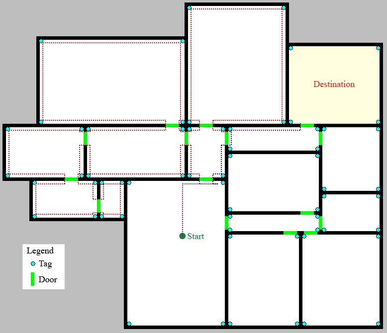
In my 8th grade science fair project, I explored how RFID technology can be used to improve robot navigation algorithms. By matching a tag to the corresponding location on its map, a robot can identify its current position and plan a route to its destination. I represented the building map as a weighted graph, and used Dijkstra’s shortest path algorithm to find the optimal route.

The robot uses wall-following to encounter tags and doors. Upon reaching the first tag, it computes the route to its destination using routing algorithms.

Robot simulation: the path of a robot using RFID-tag based navigation

Leave a Reply

Your email address will not be published. Required fields are marked *

*

You may use these HTML tags and attributes: <a href="" title=""> <abbr title=""> <acronym title=""> <b> <blockquote cite=""> <cite> <code> <del datetime=""> <em> <i> <q cite=""> <strike> <strong>